Mount Mitchell Trail Run

Like too few great mountains, Mount Mitchell was named after a stubborn preacher. Elisha Mitchell was an ornery man—it took a certain kind of uncompromising mulishness to measure mountains, especially in those early days of vertical exploration. Sir George Everest, for one, was renowned on two continents for his stubbornness. I imagine the pursuit of trigonometry will test a person’s obstinacy, much like the pursuit of the Almighty will test his patience for the unknowable. Perhaps that’s why the Reverend Mitchell found his avocations at high altitudes—whether mapping peaks or communing with God, his determination knew almost no limit. Almost.

In 1835—by then a seasoned geographer and surveyor already in his forties, and also a Presbyterian minister—Elisha Mitchell spotted a peak above the clouds in the eastern Appalachians and estimated it was the highest in the land. He spent the next nine years measuring and re-measuring it, between his Sunday sermons, until he was satisfied the mountain had no equal in the young United States of America. Even the venerable Mount Washington, named for the near-mythical Founding Father, fell in its figurative shadow.

Such a towering blasphemy, even one rooted in mathematical proofs, offended the orthodoxy. A wiry senator named Thomas Clingman—later General Clingman of the Confederate States Army and the defeat at the Battle of Goldsborough Bridge—disputed Mitchell’s claim to have measured the mountain so accurately. Clingman fancied himself an amateur geographer (he had once been a student of Mitchell’s) and dismissed his teacher’s discovery. The two men fought a war of words via the newspapers until Mitchell punted and went back to his mountain, at the notably stubborn age of 63, to measure it again.

And there he died—felled by a sudden gust of wind, perhaps, or simply a loose rock, which caused him to tumble from the top of a cataract and plunge desperately earthward. But his stubbornness lives on at the highest of altitudes—indeed, the highest in all Appalachia, as later science confirmed—as the mountain was given his name.

And in stubbornness of one kind or other, we continue to climb it.


The Trail Run:
A late-winter ascent of Mount Mitchell via the Mt. Mitchell Trail
18km (11.2 miles) round-trip
Elevation gain: 3700ft
Summit temperature: -6C (-15 wind chill)
Time: 4 hours
Nearest town: Asheville, North Carolina

With a twist:
Due to winter closures on the Blue Ridge Parkway, I ran the mountain in reverse—from top to bottom, and then back up. The Parkway was open as far as the State Park, where a paved road leads to a summit observation tower. This, in hindsight, was much more enjoyable—once I started to climb, I was already warmed up from the descent.

Drive a fun car:
The access route along the Blue Ridge Parkway is perhaps even more exhilarating than the mountain hike, especially at dawn on a cold, clear day, with a car that handles curves nicely. Check for road closures in winter.

More info:
Trail Map
Mount Mitchell State Park
Mount Mitchell Live Weather & Summit Cam
Summit Post trail description
Hike WNC trail description


Text and photos by Richard Alexander Johnson

Paddling the Powell Forest Canoe Route, British Columbia

The broadest perspective on the Powell Forest Canoe Route is the one from the top of the mountain in the middle. Here, on the summit of Tin Hat—nearly 4000 feet above the Salish Sea, on a typically cloudless late summer day—you can take in a 360-degree panorama of the canoe circuit below you: large Lois Lake to the south reflecting the humpbacked Mt. Troubridge; silver-blue Horseshoe and Dodd Lakes to the southeast; the gem of Windsor Lake hidden behind a forested ridgeline to the east; Goat Lake bending around the horizon under snow-topped peaks to the northeast; and breezy Powell Lake to the north, curving around the tip of the provincial park, disappearing beyond another mountain, and reappearing to the southwest as it empties into Powell River.

And pockmarked across your magnificent vista: clear-cuts—forest circles, machine-torn land—woven by dusty logging roads that give the impression of blood vessels coursing through a tumour. This land is a beautiful tranche of Pacific Northwest rainforest. It is also a breathing, pulsating, chainsaw-roaring timber farm. The aroma on the air is glacial dust and distant sea salt, but the flavour of the forest is lumber.

Tin Hat Mountain—which our party climbed after completing a 109km loop journey through the lakes of Powell Forest—is named for the headgear of the early (safety-conscious) loggers who harvested these trees. But this wilderness now wears many hats: recreational, industrial, historical, environmental, aesthetic. It’s complex—to call it the opposite of how wilderness is often portrayed. And the fact that we stand on the traditional territory of the Tla’amin (Sliammon) First People, ceded to the Crown in a recent treaty, certainly doesn’t make it any less complicated.

In this beautiful, complex place we found ourselves on another Canadian canoe adventure: The Powell Forest Canoe Route, Sunshine Coast, British Columbia, July, 2016.


The Nutshell
Nights: 8 (including the last one atop Tin Hat Mountain)
Paddling Distance: 109km (the traditional route is about 65km and takes 4-5 days)
Portages: 6
Portage Distance: 7.5km
Mountain Hiking: 14km (round trip)
Mountain Elevation Gain: 2500ft
Outfitter: Mitchell’s Canoe & Kayak in the town of Powell River; lightweight canoes, paddles, PFDs and a shuttle service up the logging roads to and from the lakes.


Before you go travelling,
Before you cast off,
You thank the one who looks after us all,
He will be watching over me when I cast off.
–Tla’amin invocation, as told by elder Elsie Paul in
Written as I Remember It

DAY 1: We opened with a short, 5km late-afternoon paddle after driving up the coast from Vancouver and picking up provisions in town. We were four: Mike and Dave, amphibious rednecks from Texas; and Dean and me, insufferably patriotic Torontonians.

Christie, the amiable and detail-oriented proprietor of Mitchell’s outfitter, drove us down a logging road to the southwestern corner of Lois Lake and tipped us toward a primitive but magnificent campsite on an island where the lake widens. There was no picnic table at the campsite, but there was a broad beach encircling the island studded with statuesque stumps and deadheads—sun-bleached tree trunks towering out of the water, marking the extent of the forest before the lake was dammed and flooded. A warm, night-long breeze and a pink-and-peach sunrise energized us for the expedition ahead.


DAY 2: We paddled slowly out onto the wide expanse of Lois Lake, trolling our fishing lines behind the canoes. Under our hulls: a theatre of fish. There’s a hatchery on the north shore of Lois, and fish farms buoyed in the centre of the lake. Sure enough, before we were halfway to the eastern shore we’d hooked a pair.

Our brief morning on the water—only 11km to our next campsite—was at its best when a bald eagle swooped from an unseen nest and harvested a trout from the water, while somewhere in the woods of the south shore a chainsaw or industrial feller could be heard.

We navigated our way from Lois into Khartoum Lake, through a narrow, winding canal guarded by deadheads, several of which were eerily topped with eagle eyries. Beyond, Khartoum Lake presents like an inland fjord, with steep escarpments of conifers towering above each shore. A small cove on the north shore holds the lake’s only campsite (which was occupied, so we made camp on the beach next to the campsite).

Khartoum is an extra appendage off the regular Powell Forest route, but we found it worthwhile to explore. After setting up camp and napping, Dave and I paddled to the eastern end of the lake—an easy 5k each way—and caught a dinner-sized cutthroat trout for our efforts.

Cumulative: 26km paddling; 0 portages


Sweet sleep, come to me,
Underneath this tree.
William Blake

DAY 3: Khartoum Lake was absolutely still and a silent curtain of clouds gently glided over the mountaintops. The morning was saturated green. But when our paddling returned us to Lois Lake, back through the deadhead channel, we felt the rush of an easterly wind in our faces. It started to drizzle and—to add superfluous drama—we discovered a strong current working against our progress. It was a gritty three-hour paddle to the portage on the far northwestern shore, and the eagles watched us as we went slowly by.

The portage from Lois to Horseshoe Lake is practically manicured—a 1.7km stroll in the woods alongside a roaring creek. The rain let up (it would never again return), and we enjoyed our third meal of the day (we averaged five) before pushing out onto Horseshoe (probably named before the advent of aerial photography).

Flanked by low hills covered in cedar and fir, Horseshoe was bright and warm and remarkable for being the only lake from whose waters we didn’t hear the sounds of logging. Thus the logjam blocking access to the portage trail on the lake’s northern shore was a bit ironic.

From Horseshoe the Powell Forest route diverges. Paddlers can choose between the northwest portage route via Nanton and Ireland Lakes, reputedly easier but noisier (nearby is the jugular of the logging-road network, and Nanton Lake’s campsite is popular on weekends with locals); or they can choose the northeast route, pond-hopping in solitude, as we did.

Our reward for the 1.6km uphill slog from Horseshoe to Little Horseshoe Lake was our first taste of old-growth, with giant ferns carpeting the forest floor beneath thick red cedars, hemlocks and alders.

“Looks like ya gotta lil’ hitch in yer gitalong.”
One Texan to the other; roughly translated from the redneck as “It appears that the portage beat the hell out of you.”

Loaded down with our camping outfit, tons (almost) of camera gear, two canoes, and a food barrel heavy enough to sink a barge, the Little Horseshoe portage nearly crushed us. But on the far side we found it was just a short paddle to a warm campsite. We swam in the lake and photographed frogs and giant slugs and glistening sundews—a relative of the Venus flytrap—in whose habitat we made our camp.

Cumulative: 44km paddling; 2 portages


“Their canoes were small, with projecting prows, and dug out of one piece of timber, each with four or five small thorts, and some had their outside ornamented with rude figures painted with red ochre. Their paddles were short with round handles and pointed blades.”
Dr. Archibald Menzies, physician of the HMS Discovery, upon making his first contact with the Coast Salish Peoples in 1792

DAY 4: By now we’d lost count of the eagles, and the days were only getting hotter. We paddled and portaged our way from Little Horseshoe via Beaver Lake (a pond, really) to Dodd Lake, a quiet 7km paddle in a long green bowl. Now and then we caught a glimpse of snow-topped mountains through gaps in the hills on the eastern and northern shores, conferring a sense of entering the mysterious middle of something. And to the west, briefly, we saw the summit of Tin Hat behind a ridge.

At the top of the lake: a lonely cabin, with a dock and a diving board; no such place should be empty on a beautiful day like this, but we were almost disappointed to discover that it was. Just then, though, our solitude was broken when we neared the portage trail and saw eight large, heavy, red canoes piled on the dock. A pack of droopy-shouldered teenaged summer-campers emerged from the forest carrying enormous backpacks and barrels, heading south in the opposite and unorthodox direction.

The portage to Windsor Lake sloped upwards and crossed a narrow logging road near a waterfall, and when after 500 metres we reached the new water we stood stunned, for we had reached the heart of the Powell Forest route—the highest lake—and it was as magnificent as other expedition accounts alleged it would be. Steep, forested escarpments on every shore; a firm but benevolent swirling wind; and the dome of Rainbow Mountain like a neo-gothic cathedral in the north.

Barely two and a half kilometres end to end, Windsor Lake compelled us to slow our paddling and admire its peerless natural engineering, though before long we heard the low groan of a loaded logging truck heading out to market.

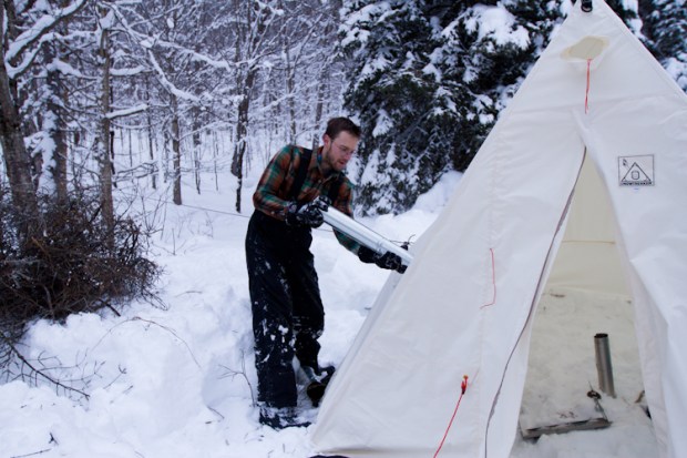
We found Windsor’s acclaimed campsite nestled in a picturesque grove of old-growth forest, with a swing hung from a tree and a pit-toilet carved into a dually-sized tree stump. Here we pitched our tents on soft undergrowth beneath a towering canopy of red cedar, Douglas fir and hemlock, with sour blueberries and Devil’s Club and great ferns all around.

For nature-seeking paddlers like us who’d never before seen a cedar tree broader than a racecar steering wheel, the Western Red Cedar attracted our reverence. From its watertight, malleable trunk-wood the Tla’amin and other coastal First Peoples carve their dugout canoes (a number of which are displayed at the Museum of Anthropology at the University of British Columbia in Vancouver).

Windsor Lake was cool and still in the evening, but no fish bit hard. We sat around the campfire after a supper of falafel burgers puffing on cigars, wishing for nothing.

Cumulative: 55km paddling; 5 portages


DAY 5: A portage-only day, as the route from Windsor down to Goat Lake is more than two kilometres of trail zigzagging down nearly 700 vertical feet. It took us three hours to make two trips carrying gear and canoes to Goat Lake campsite (at least the food barrel was lighter—can’t seem to stop eating).

Once we had set up camp and napped (and restarted the day with a fresh pot of coffee), Dean set out back up the mountain with his cameras while Dave and I loaded a canoe with fishing gear and set out on the lake. Mike occupied himself fixing broken tent zippers and keeping the hammock from feeling lonely.

A funny thing happened that drizzly day back on Lois Lake: a ziploc bag failed, and our lone (and patently un-waterproof) map became saturated and unusable. I had only the vaguest memory of how long Goat Lake was, but I failed to indicate that vagueness to Dave when I proposed the afternoon trip. “Just an easy 5K.” It is, in fact, ten each way.

When we reached the head of the lake we found the mouth of the Eldred River, and having heard that this was the likeliest place along the circuit to spot a grizzly, we paddled another two clicks up until the current proved too swift against us. The snowy range of mountains to the east delighted our eyes, but alas, no bears played a part in this story.

Cumulative: 79km paddling; 6 portages


“There’s a breeze that comes across Powell Lake every afternoon; you might have heard of it. The lake can get a bit uncomfortable.”
– local man fishing in the channel between Goat Lake and Powell Lake

DAY 6: We had been forewarned about the strong winds on Powell Lake—the standard advice is to paddle it in the morning, nap all afternoon, and paddle it again in the calm evening—and thus we got a very early start, hoping to make 23km to the next campsite before the “breeze” came in from the ocean.

By noon we had crossed the central corridor of the dipper-shaped lake—gazing as we paddled at the enticing cabins on the south shore and the scarred clear-cuts on Goat Island to the north. Around the bend, where the lake turns southward in a 9km funnel to its outlet, the weather abruptly changed, and within minutes of resting in a placid cove we found ourselves knifing into a burly headwind, battling whitecaps and two-foot swells underneath a bright, teal-blue sky.

“There’s an uncomfortable amount of water in this boat.”
Mike, in the wet seat in the bow on Powell Lake

Tired and rendered nearly inaudible to each other by the wind, we also somehow got lost. We were, you’ll recall, map-less. Our weary collective brain recalled that our next campsite was supposedly located at the crown of a small cove, near a beach and a trailhead leading into the provincial park. But there were several coves, and they all had beaches (and cabins, too).

And so I met Ernie Larsen—71, retired logger, proudly Swedish of stock, charming repository of heritage factoids—who spends each long, Sunshine Coast summer at a cabin on a beach in a cove on Powell Lake. I met Ernie when we decided we had to pull over to ask for directions, and though he warned me that he wasn’t completely certain, he thought it likely the campsite was located one more cove down the lake, just beyond a lonely cabin (of course he was right).

After a brief guided tour of Ernie’s cove, I returned to meet my sweltering comrades and we pushed out once more into the wind. The waves pounded the boats, and we steadied ourselves against each undulating swell. After twenty minutes we spotted the campsite on a high bank looking over a gravel beach (with a rope swing, rated to somewhere south of 200 pounds).

Then, as if by a child’s whisper, the lake became completely still at sunset. Dean cleverly made a “leftovers” stew and we cooked bannock over the campfire. Another party of boisterous, clockwise-journeying summer-campers joined us rather late in the day, but we slept hard and fast that warm night.

Cumulative: 102km paddling; 6 portages


DAY 7: It was a quick, 7km morning paddle to Mowat Bay and the terminus of the Powell Forest Canoe Route, and then it was Pale Ales, burgers and mussels at the Shinglemill Pub on the lakeshore. We resupplied in town with treats—cheese and bagels to feed a platoon; a thick slab of sockeye salmon—and drove back up the network of logging roads, deep into the forest to Lewis Lake, near the base of Tin Hat Mountain. We caught a few small trout off the campsite’s dock, but preferred our salmon grilled over cedar.

Owls screeched at us—they scared the musky crap out of us—as we sipped whisky and (with a fresh new map) studied our route up the mountain for the next day’s climb.

Cumulative: 109km paddling; 6 portages


“Even now, these forests have an infinite feel—until you see the clear-cuts and realize how extraordinarily efficient humans can be at altering the landscape. Out here, empty spaces still look like wounds, like violations of the natural order.”
John Vaillant, The Golden Spruce

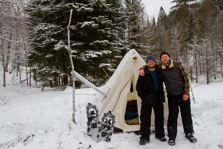
DAY 8: From Lewis Lake, the elevation gain to Tin Hat’s balding summit is about 2500 feet (from the north, at Fiddlehead Landing, the gain is 1000 more). Here our journey came into alignment with the popular Sunshine Coast Trail, a 180km trekking route paralleling the coastline from Desolation Sound to Saltery Bay, which is studded with huts like the one atop Tin Hat.

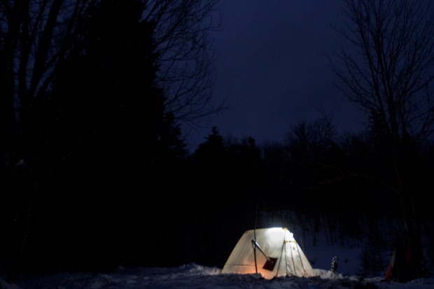
Five hours after we broke camp in the morning—through thinning forests, across logging roads, around blistering clear-cuts, up and over shaded ridges—we reached the top and inhaled the view. We moved into the hut, a perfect creation with its pellet stove and loft that sleeps 10ish. We sat on the naked summit at dusk. In every direction, mountains. And beneath them, our canoe circuit. The sun graciously took half a lifetime to set, and the forest faded into shadows beneath our feet.

Text and photos copyright (c) Richard Alexander Johnson, 2016


Hot Tent Winter Camping

Kneeling on frozen ground, his body half broken from the slog into camp, Dean sucks in two lungfuls of winter Ontario air. He holds it for a moment, then releases a torrent of breath into the steel-sheeted stove nestled in a shallow bed of snow. Strips of birch bark somersault over spruce twigs, both catching sparks from a smouldering newspaper. Yellow flames limp to life from the thawing fibres of the wood. Another breath. The newspaper glows and the bark is lit.

On canoe trips Dean earned the nickname one-match. Invariably a man who answers to the call of one-match is the man you want in charge of the heroic act that weary ancient cave-dwellers desperately discovered: Make the food hot.

A man called one-match in your camp is convenient when it’s eight below zero and you’re about to set up your sleeping bag on top of several feet of Canada’s most abundant natural resource.

Minus eight degrees Celsius may not have the same ring of potential misfortune as Siberia or the Tundra or the Death Zone of Everest, but we’d secretly hoped Algonquin Park would take it easy on us. Besides, cold is cold when you spent last night under a duvet in the city. We were beaten down from the long day on snowshoes and hauling pulks, and now we were laying back in our snow chairs, neither fully awake nor asleep, sipping bourbon from titanium mugs.

It takes a quarter of an hour of tenderness, but the fire kicks to life. Dean grimaces, either because he considers his handiwork imperfect—pyromaniacs can be such perfectionists—or because he is unable to stand on his aching legs. I sit to his left on an uneven rectangle of stamped snow that will become my bunk. Shoulders hunched over knees, I stare straight through this ostensibly enchanted steel box now throbbing with heat. “My god,” I say, half dazed. “There’s a fire inside our tent.” Winter camping will never be the same.

As the frozen season descends on Canada, most of the country’s exquisite wilderness is inaccessible to all but the bravest, hardiest or possibly looniest of outdoor adventurers. But the option of hot-tent winter camping—literally, camping with a wood-burning stove inside your tent—encourages those of us trippers who tend to be a bit more risk averse to blaze trails deeper into the woods and mountains, where we can experience Canada’s tranquil winter landscapes like we may only have imagined previously from heated cottages and the odd yurt.

In winters past I hauled my lightweight nylon tent into one or other of Ontario’s provincial parks to hike, ski or snowshoe. Daytime temperatures of minus twenty were no match for the promise of unbroken acres of pristine terrain, shimmering vistas of ice-entombed lakes, and layers of comfy merino wool and eiderdown. But those same temperatures come nightfall compelled me to reconsider my courage, as I dreamt hopefully in the darkness for a warm fireplace.

After one too many nights shivering myself to sleep inside my bag, numbing myself to the thought that every cold and damp sock, shirt, glove and boot in my possession will likely remain cold and damp throughout the rest of trip, I decided to pursue the hot-tent option. And I convinced one-match Dean that it was more hardy than foolish.

Just off exit 244 of Highway 11, the corridor through Ontario’s Muskoka cottage country, lies the town of Emsdale, where the post office opens lazily around 9:30am in the event that, like us, you overshoot your destination, stare blankly at a confused map app, and need to ask a human for directions. Here in Emsdale, in a tall, copper-roofed visitors centre, a shop called Algonquin Basecamp is currently the only outfitter within eight hours’ drive from Toronto that rents a complete hot-tent winter camping set.

Chris, the thirtyish proprietor with a carpenter’s build, greets us with a handshake and a smile. Somewhere in his mind he’s probably sizing us up, taking stock of the impression we make and how likely he is to have to rescue us from the woods, or worry that he’ll be staring at the char of burnt tent scraps when Dean and I return three days hence. But he doesn’t display any great concern as he leads us toward two sturdy canvas bags each the size of checked luggage. In one, an eight by ten foot A-frame canvas tent; in the other, the longed-for stove.

Cups of strong coffee in hand, Chris gives us a brief tutorial on the set up and a part-by-part accounting for every piece in the set, encouraging us to ask every question we’ve been pondering ourselves over beers for the past month. After which he confesses that he won’t rent these outfits to just anyone who calls. “Sometimes you get people in here that seem not to know what they’re doing,” he says tactfully. Then he recounts a few tales, with no hint of bravado, of people and gear he’s rescued from the woods, or at least stayed up late worrying about.

“It’s a fire inside your tent,” he concludes our how-to session. “So obviously there are constant risks. Before you leave your tent in the morning to go on a hike, the fire’s out. Before you go to sleep at night, it’s out. Out means completely out. Not a single coal lit.”

We shimmy the canvas bags into the back of Dean’s diminutive blue Nissan alongside the rest of our gear, and pull out onto the highway quizzing each other about the lesson of the hot tent. As we exit onto Highway 60—the route that traverses Algonquin’s southern woodlands—we’ve convinced ourselves, one last time, that we can do this. “What about Big Agnes,” I ask, referring to the ultralight nylon summer tent I’ve brought in case we can’t figure out the hot tent in the backcountry. “Leave it in the car,” Dean replies confidently.

The Western Uplands Trail snakes westward from its junction with Highway 60 and up a series of hills toward kidney bean shaped Maple Leaf Lake, whose shores make popular camping ground for summer canoeists. In other seasons the sloping landscape appears thick with sugar maples, yellow birch and beech trees, this being the most deciduous zone of Alonquin Park. In winter the scene is fully monochromatic: foggy whiteness slit with columns of bare grey tree trunks, snow tufts clinging like babies to their northwesterly sides.

When Algonquin Park was originally designated a protected area in 1893 its framers imagined the “preservation of a primeval forest… a place of health resort” and “a field of experiments in forestry.” If primeval was intended to stand for a place of ethereal beauty and quiet terror in winter, the word was well employed. For more than a century hikers, skiers, trappers and loggers have plied these snowy trails in search of some fortune, whether profit or good health or a satisfying “We did it!” moment. Pulling into the trailhead parking lot we imagine what lies ahead: perhaps a tangled pile of tent parts in a hole in the snow, and two confused campers, having failed at their particular experiment in forestry, sitting beside it in the cold dark.

Dean and I strap ourselves into our long, tangerine pulks, each filled near its tipping point with minus twenty degree down sleeping bags, wool long underwear, flannel shirts and many other layers of warmth. We’ve twelve pounds of photography gear squeezed into padded nooks of our camera bags, plus a full kitchen of two lightweight camp stoves, forty-six ounces of white gas, pots and pans and enough salami, cheese, stew, chocolate and chicken noodle soup to feed a famished Boy Scout troop.

Evidently we believe three days’ caloric consumption in winter is equivalent to a week’s in summer. “Prediction,” I announced the first evening as I rummaged through a red waterproof food bag for an appetizer while Dean’s beef stew simmered on the stove. “We won’t be carrying any food out of here on Sunday.”

The three-kilometre snowshoe trek uphill from the trailhead transforms our hamstrings into piano wire. Over a small rise in the landscape the trail plunges toward a babbly stream, heard but not seen, and halfway down and about twenty meters to our right is a flat clearing, evident of a snow-covered pond. We drag our outfits no farther than its far shore, where a patch of soft snow—treeless except for a great white fir—allows us to declare camp.

Conjuring enthusiasm, I pant, “This looks like our spot.” Dean huffs out an agreement. “Grab the shovel. Time to make a home.”

My fingers grasp a flap on one corner of the tent and curl it, as I grunt, around the upright aluminium tent pole. The canvas feels heavy and cumbersome in the cold. We inch it over the A frame—a pair of two-meter-tall triangles leaning inward and separated by an equally long centre pole—and strap down the other three corners. Tying off a few guy lines on the fir tree, we proclaim that at least we’ll have a roof tonight. The floor is eighty square feet of snow.

The afternoon wanes. A cool fog has settled over the landscape. We pull out the stove: a steel box, nineteen inches long, twelve high, with two flip-down leg stands and a door at one end; a set of telescoping stove pipes plus an elbow; and a cache of steel wire and cutters for improvisations. The whole kit weighs about seventeen pounds. One side of the tent wall contains a six-inch hole, lined with Kevlar, for the chimney. Once the stove is assembled, we erect a bipod outside to hold the weight of the pipe. Then we march off into the woods to collect fallen limbs for fuel. One-match Dean feels a sense of duty as he grinds his saw into a branch of maple: if he’s going to haul a stove into the winter backcountry, he’ll at least give it the honour of a blazing fire.

As a cloudy darkness envelops the campsite and the day’s fresh powder hardens on the ground, the stove is turning our tent into a sauna. Damp kindling—and the constant stoking required to coax the fire to a temperature hot enough to ignite hard wood—produces a steady plume of smoke inside the tent. With tears in my eyes I fumble for the tent flaps while Dean doubles over coughing. It feels a little humiliating, getting smoked out of our own tent. After a few breaths of fresh air I say something sheepish to Dean along the lines of, “I’m glad the bears are hibernating, and can’t witness the two of us trying to work a stove in the woods.”

After airing out the tent, we dry our wood on the stovetop next to the tea, and eventually, a crisp, hot fire is crackling inside the stove. Dean takes a pull from his flask and wonders aloud how we won’t last another half hour awake. It’s barely 5p.m. I lean into the snow bank I’ve crafted for a bed frame and think about absolutely nothing. The smell of stew lingers on the warm air.

All photos by Dean “One-Match” Bradley

High Park Trail Run

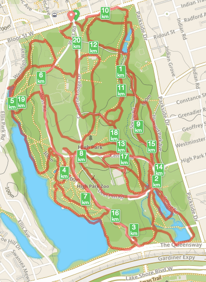
My wife and I often refer to High Park as our backyard. Among the amenities we lack, living in a typical west-end apartment—700 square feet of compartmentalized hobbit holes on the second floor of a detached brick house; dinner parties of 5, max, if one of you doesn’t mind sitting on the IKEA footstool with a plate on your knees—is a patch of wildness to call our own. Perhaps with a Japanese maple tree. Organic marjoram. Heirloom tomatoes that grow large and fecund beyond the emaciating constrictions of dollar-store clay pots; healthy and natural instead of skinny and leaning to the southeast from the balcony, pitiably seeking warmth from a Toronto morning sun.

We both grew up with backyards. Hers, in rural Nova Scotia, was an enormous grassy hill reaching down to the grey sea, perpetually washed by salty winds that blew children sideways and deposited on the laundry the yearning aroma of a distant sea-storm.

Mine, in suburban south Texas, was half an acre of twisted Mountain Cedar–achingly resilient against the white, brutish sunlight of August–and foot-tall fire-ant hills whose perforation at the whip of a doomed lawnmower blade or at the curious poke of a ten-year-old unleashed a throng of six million six-legged red demons, to the apparent delight of all parties involved.

One of the sacrifices I made to downtown city life is the backyard. I want to live in an electrifying hub of cultural, economic and artistic energy with millions of other people, but occasionally I’m anxious if I can’t escape into the (imagined) limitlessness of the childhood backyard, with all the mental freedom it engenders. I believe that was one reason we created parks: we needed some space in our cities to be calm, to be unformed.

I started trail-running in High Park about two years ago because pavement makes my feet cry and most gyms are dank, florescent-lit human zoos that smell of tears, peroxide and vanity, and the last thing I want while releasing my anxious energy into the urban cosmos is to look at myself in a twelve-sided mirror as I grunt at a dumbbell.

As a child my backyard was large enough to contain me and my need to run around in circles shrieking with senseless ecstasy as I splashed mud up my calves and trampled my mother’s rhubarb.

As an adult who still delights in mud and trampling as a way to push back against the constrictions of the city, I simply need a larger yard, preferably one that feels wild, where I can occasionally belt out a line of AC/DC lyrics, forgetting for a second that I’m not actually alone in the real wild, and startle the hell out of a hoodied dog walker as she scoops up terrier shit.

IMG_6193

To provide forage to cattle was the founding objective of Boston Common, the oldest (colonial) park in North America, where for two hundred years residents shared the land to graze cows—and hang pirates and Quakers—before overfeeding and the Industrial Revolution began to transform the park from a cow pasture into a human sanctuary. Still, even as a suburban cattle range the Common was from its very beginning a place of compromise between the facility of town life and the tranquility of living wildly, by one’s own means and creativity.

“You can neither lie to a neighbourhood park, nor reason with it,” wrote Jane Jacobs in The Death and Life of Great American Cities.” She was arguing that the chemistry of urban planning alone cannot make a good park; its uncommonness is what defines its utility: “[I]n real life only diverse surroundings have the practical power of inducing a natural, continuing flow of life and use.”

I infer she delivered even more from that statement; by its very nature a city park must be a bit different, a bit wild. Like fire ants or an ocean wind. Like the gallows’ justice. Like an unrestrained heirloom tomato (I dare to dream).

High Park Trail Run, Route 1: The 20K Criss-Cross

In which the writer asks, How far can he run on High Park’s trails and hills without covering the same ground twice, relying only on his mental map and his heavy-metal iPod mix, and without regurgitating any gummy bears?

20.3 kilometres and 1125 feet of elevation gain entirely within a city park of just under 400 acres. Some shrieking. One zoo. No mirrors. Recommended for grown-up Torontonians in need of a childlike backyard just wild enough for the city.

22 views on Lower Bay Station

This evening I had the enviable opportunity to accompany Spacing magazine and two dozen Toronto photographers, history buffs and assorted scavengers to Lower Bay Station–a.k.a. “Bay Lower” a.k.a. the “ghost station“–for a TTC-organized tour and photo shoot. #LowerBayTour.


All images copyright © Richard Alexander Johnson.

You might also like “23 Magical (Non-Magic) Mushrooms

My work on Twitter & Instagram.

Rouge Park Trail Run

Version 3
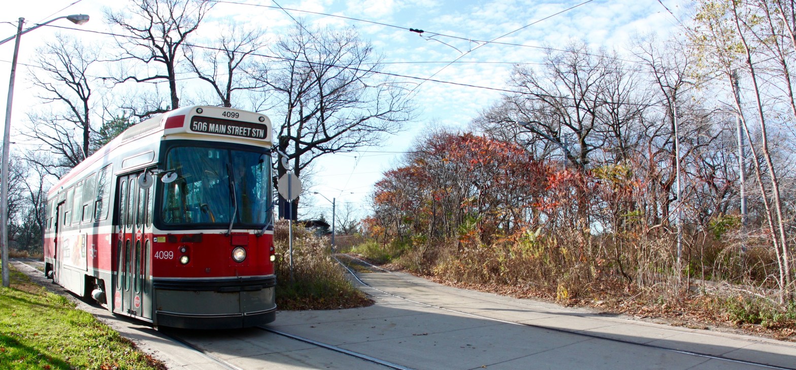
Very quietly, almost without notice amid the roar of traffic on the 401, the Government of Canada is setting up a national park in our horizon-stretching, sky-piercing mega-city.

When it’s finally ready, visitors will be able to stroll, hike, cycle or run from Rouge Beach in Scarborough to the Goodwood Conservation Area in Glasgow, a crow-flying distance of some 25 kilometres, during which they will follow the meandering channels, ponds and ravines of the Rouge River and its squiggly tributaries—around, over, under or through the Toronto Zoo, several commuter and freight rail lines, highways 401 and 407, acres of private farmland, several golf and country clubs—from Lake Ontario to the Oak Ridges Moraine, via a network of trails, paths, windy roads, bridges and underpasses that might make any regular visitor to Banff snicker with pity and choke on his protein bar.

Rouge Urban National Park, proposed boundaries (Source: Parks Canada)

Sure, Rouge National Park is still closer to a grand idea than it is to Banff or Gros Morne or Quttinirpaaq, and even when it’s complete few visitors will confuse it with the towering escarpments of Auyuittuq, the thundering cascades of Nahanni, or the Switzerland-sized beaver realm of Wood Buffalo.

But we’re talking about a metropolitan area of some 6 million inhabitants, smaller in size than Jasper, containing—with the rest of its urbanity—a national park. That’s a lofty ambition, and one worth exploring.

For the time being, Rouge Park sits diminutively on about 40 square kilometres of a delicate riverine ecosystem, created by the Province in 1995 to protect an extension of the Greenbelt—a network of wetlands and aquifers that provides much of the drinking water to southern Ontario’s 13 million residents—amid the sprawl of amalgamated Toronto and the suburban townships of Pickering and Markham. In 2011, the Federal Government committed $143.7-million to a ten-year process of establishing a national park in Rouge. The House of Commons passed the Rouge National Urban Park Act on January 26, 2015, and in July, an additional 21 square kilometres in the township of Uxbridge were added to the survey.

In total, the Rouge initiative will consist of 79 square kilometres of land belonging to Toronto, Pickering, Markham, Uxbridge, York Region, Durham Region, the Province of Ontario, and myriad public and private interests.

IMG_4747At present, evidence of Parks Canada in Rouge is limited to a small information cabin, located next to the Rouge Valley Conservation Centre, and an adjacent demo oTENTik. But it’s all coming, said the pair of contract Parks Canada employees when I visited their hut on November 1, the last day of their season. They showed me a map (not yet published) of the eventual park complete with dotted lines promising a contiguous trail network linking the existing park with the proposed additions to the north.

In other words, an ultra-distance, mixed-surface, cross-country trail within a protected area of land, just twenty minutes (in Sunday-morning non-traffic) from downtown Toronto: an urban, off-season trail-runner’s dream.

Rouge_Park_Trails

Rouge Park Trail Run, Route 1: Glen Rouge Campground to Woodland & Back (21.6km)

Rouge Park on a typical Toronto autumn Sunday seems to wake slowly, like the city itself. Just after dawn—on the morning following the end of daylight savings—there are already a dozen cars in the Glen Rouge Campground / Mast Trailhead parking lot off Kingston Road, but few souls are seen. [Download Trail Map]

For today’s discovery run—it’s my first visit to Rouge—I head north with an iPod, a folded trail map, a baggie of sliced grapefruit, and a handful of gummy bears—along the series of connected trails called Mast, Vista and Cedar, following the Little Rouge Creek ravine over several hills and through a canopy of fall-coloured oak, maple and walnut trees. (There’s a great organization—called 10,000 Trees for the Rouge—devoted to tree planting and arboreal conservation in the park.)

Arriving at Meadowvale Road near the zoo, and out of trail for the moment, I head south to Old Finch Avenue, west to Reesor Road, and then north to Steeles Avenue (mostly on a gravel surface beside the roads), crossing two sets of railroad tracks. At Steeles, I meet up with Little Rouge Creek again and follow the Woodland Trail south to its dead-end at the CN rail tracks.

Once again I’m out of trail, and to continue southward to connect back with the rest of the trail network, I have to run for about a kilometre alongside the tracks (pausing my music to listen for trains) to the Plug Hat Road bridge. After a bit of a scramble up the slope, I’m back on a road for about a click to meet up with the Cedar Trail.

By now, other weekend warriors abound on the trails; I’m overtaken by a high-school cross-country team out for practice, and all of us are stepping around couples, families, dog walkers and others enjoying a Sunday stroll with their smartphones poised to Instagram the lingering fall colours.

I return to the Glen Rouge Campground roughly the same way as I ran outbound, except I take the Orchard Trail down the eastern bank of the creek to Celebration Forest, meet up with the Mast Trail once more, and after a few last uphill climbs (the Mast Trail is the hilliest section of the entire run) I bear west at the fork to follow the trail along the Rouge River back to the parking lot.

Finish! A little more than half a marathon, a little more than two hours, on a perfect autumn morning in a national park in the city of Toronto. Time to eat pie.

Got tips for Rouge Park Trail Running, I’d love to hear them. Email or Tweet at me, or something.

Photos and text copyright © 2015 Richard Alexander Johnson

I Built a Wooden Canoe Paddle (Partly Because I’m a Wilderness Snob)

Confession: I am the guy on the canoe trip who pitches his tent according to where the sun will rise. I’m the person who shoots nostalgic, postcard-like photographs of canoes lined up on the riverbank, who quotes from Thoreau simply because Thoreau was there, who noted in his journal the precise sunset times for each date and latitude so he’d know exactly when to set up the tripod for magic hour. I’m that guy.

You probably know this person. He sings folk songs in the stern when the headwind is strong so the wind carries his off-key voice upriver. He picks blueberries for his bannock. He knows most of the important knots. He smiles when it rains. He paddles harder when there’s a chance to overtake another party and beat them to the best campsite. He owns three titanium sporks, one of which was a wedding gift.

Yeah, that guy.

Allagash-81


On a recent canoe expedition in a remote stretch of the North Maine Woods the only outfitter within range of our launch had no paddles to rent except the kind with an aluminum shaft, a plastic blade and a plastic grip.

Canoeists prepare to launch into the Allagash River with five unsightly paddles.

Does the guy who still brings those 80s-era barrels on his canoe trip at least in part because they’re so very photogenic want to hold a plastic paddle? Not in the least. He’s something of a wilderness snob, to whom the sight or feel of a plastic paddle is anathema.

I realize that other materials might be stronger, lighter, more durable, come in bright colours, cost less, and not directly involve the destruction of a living organism. I respect that some outfitters expect the precious gear they rent out to be treated like a grizzly treats a beach ball. (Or a Goodyear.) I’m honestly not unaware that the canoe is plastic, those translucent neon water bottles are plastic, those allegedly photogenic barrels are plastic.

Yet in the face of evidence in favour of plastic, I respond with this: Imagine a pair of paddlers plying a lake, singing songs into the wind, propelling themselves in a siren-red canoe on the surface of the reflective, undulating water of an idyllic lake as summer slowly wanes into autumn. What kind of paddles are they holding?

They’re holding wooden paddles.

(So imagines the wilderness snob.)

At some point on our trip I said to my friend Mike, “Next time, we bring our own paddles.” He, a custom furniture maker and my paddling partner on many expeditions, replied, “Next time we make our own paddles.”

Gratuitous moose photograph
Gratuitous moose photograph. I imagine the moose hates plastic paddles, too.


I can build you a paddle in my mind. The rough-cut rectangular slab of reddish-brown mahogany—six feet long, fourteen inches wide, an inch and a half thick—is coarse and prickly to the touch, calling to mind the defensive outer layer nature gives a cactus or a hedgehog. Inside this bristled skin could be a patio bench or a quartet of nightstand table legs or the re-commissioned altar of an old parish church. But trust me when I tell you: inside this board of wood is a canoe paddle. You’ll be able to confirm this from the form the wood exhibits once the outer later is removed.

There will be a strong, perfectly balanced piece of smooth, light-amber mahogany, fifty-eight inches long. One end—about forty percent of the total length of the form—will appear to be flat: its tapering aspect ratio, nine-to-one at its widest point, may remind you of the tail of a beaver, though this particular paddle design is named after the beaver’s very distant aqua-mammal cousin, the (in fact pointy-tailed) otter. The other end of the finished piece—the remaining sixty percent, roughly—will appear as a long cylindrical shaft, like a thick broom handle, perfectly round except for a cloved grip on its end, like someone grafted a pear onto the end of carrot.

In your hands—one of which cradles the half-pear tip while the other grips the shaft just above the beaver tail—the paddle will draw your body sideways and downwards in a way that suggests both a desire for balance and an opportunity for locomotion. Indeed, the feeling of imbalance inherent in the form of the object, as held, is corrected, in a sense, by the function of its motion. This, in the end, is how you know you’re holding a paddle (and not a table leg or a church altar): you experience the urge to paddle.

Voilà—I’ve just built you a paddle. Except I didn’t. I think I just imagined you a paddle. It was Mike who truly built it.

Version 2


A master craftsman (a term I’ll apply notwithstanding his humble protestations), Mike built a paddle—two, in fact—from that slab of mahogany. First he sketched a design from mathematical calculations onto a drab yellow piece of fibre-board, and then deftly ran that board through a band saw along the paddle-shaped pencil lines he’d drawn.

Having refined the shape—partly by calculation, partly by squinting at it in the way a surveyor peers at a horizon line—with calipers, a sliding bevel and an orbital sander, he leaned the scale model of the paddle against the still-rough mahogany and declared himself satisfied that, having never attempted such a project before, a paddle—two, in fact—would emerge.

In stage two, Mike—earmuffed to dull the noise of machinery—fed the mahogany slab through a surface planer until it was smooth and whiteish and emitted the pungent, nostalgic aroma of a freshly built Mennonite barn. Then he re-traced the form of the model paddle in duplicate on the mahogany surface and fed it again to the band saw, slicing it lengthwise in two, one long thin slab for each eventual paddle.

And here the stories of the two paddles diverge slightly, like a river that empties from a lake in two places and re-converges a few miles downstream. Mike lay one slab back on the band saw and cut a near-perfect outline of the paddle, tracing a line down the shaft and around the blade and again up the other side to the pear-shaped grip, expertly rotating the board to accept the whirring saw-blade at its desirable angle.

With the second slab—the second paddle—my untested hands insulted the saw with the inexactness of their motion, and in one fatal moment, as I tried to back the board away from the blade of the saw in order to attempt to angle it around the blade of the paddle, I miscalculated where my forward progress would recommence and accidentally sent the saw-blade almost half an inch deep into what would become the shaft of the paddle. Ruin!

Clamps holding together the wood on my saw-scarred paddle.

Or so we initially thought. Despair, however, was short-lived, as Mike engineered a solution that involved cutting out—with a router and chisels—a ten-inch-long section of the shaft to the depth of my accidental cut, and replacing it with a ten-inch-long cut of scrap mahogany, which he glued as an inlay into the cavity. Thereafter our two paddles became distinct: his, still solid; mine, now technically two pieces of wood enjoined.

The day and the woodshop grew hotter, and to our roughly hewn semi-shaped boards we plied the woodworker’s hand tools—the spokeshave, the rasp, the hand plane—until, at last, the shape of the emergent canoe paddle crossed over from a state of angular coarseness to one of curvaceous refinement, resembling little of the original prickly, reddish-brown board from which we started.

We sweated our way through the last artisanal stage—softening, smoothing, and rarefying the wood with increasingly fine grits of paper on an orbital sander until the surface, to the touch, recalled the cold glassiness of marble or silver, yet retained just the faintest expression of warmth and fibrousness that characterizes the uniqueness of wood—and considered our efforts satisfactory when our clammy, grit-dusted hands felt relief in the creamy expression of finished wood.

To close, we applied with a rag a varnish of linseed oil and resin to return the surface of the paddle to the colour of aged Bourbon, and to protect the wood from the lakewater it was designed to cleave.


I swear I wasn’t born a wilderness snob, nor did I cultivate the personality absent a critical self-consciousness. (Sometimes I lay in my tent at night and think, “Did I really need to look down my nose at those bespandexed amateurs with their portable MP3 speakers and two-fours of light beer in the wilderness?”)

Fortunately a good wilderness snob surrounds himself with knowledgeable, humble friends. My gratitude to the craftsman for ensuring that never again will we paddle in plastic. Except for those blue barrels. They’ll never fall out of style.

7 Books of Creative Non-Fiction & What They Say About 2014 Me

This year I read a lot of books. Not nearly as many as I wanted to. Books that came to me easily (attending the book launch/tour/cocktail party), unexpectedly (an Indian priest handing me an obscure anthology of 19th century French missionary diaries), warm-summer-daily (the annual literary rummage sale known as Word on the Street); by word of mouth or bookstore drop-in or a wife who appreciates my insatiable appetite for the genres of literary/creative/narrative non-fiction.

Here are 7 memorable non-fiction books I read in 2014—not necessarily that were published in 2014, although one of them actually was—and recommend, plus a belated attempt to derive meaning from the choice or chance to devour them.


1. The Book of My Lives, by Aleksandar Hemon

The Balkan War was my adolescent war. The summer of ’92, when Serbian tanks and paramilitary units encircled Sarajevo, I got my driver’s license and discovered NPR. I recall listening to wailing interviews with Bosnian refugees and intrepid journalist Robert Kaplan trying to make sense of it all. By the time the guns went silent in the graveyard of Treskavica as the Dayton Accords were signed, Kaplan had published his influential Balkan Ghosts and I was in university reading the news on a computer screen.

In The Book of My Lives, novelist Aleksandar Hemon remembers Bosnia as a childhood lesson in the politics of multiethnic federalism and the war as the violent rebellion against the spirit of uncertain togetherness which characterized Yugoslavia after Tito. When he inadvertently insults a boyhood friend by insinuating that his choice of clothing painted him a Muslim, the writer feels for the first time the unbearable sadness of othering; no longer is there such a thing as one for all.

Hemon, author of four novels including the much-celebrated The Lazarus Project, grew up in Sarajevo but found himself in the liminal space of the war as a refugee in Chicago. His accented voice was like those I remember on NPR trying to explain to Americans what Bosnia was, where Serbia began, where Yugoslavia ended.

The author as memoirist is at his most poignant when he inhabits the disfigured memory of others. Most notably that of his adolescent best friend, Veba, whose father was taken as a POW by his own country’s army on suspicion of being not Bosnian but Montenegrin Serb. After two years of anguish, Veba was offered the chance to visit his father provided he agreed to participate in a propaganda stunt to demonstrate the humanity of the Bosnian military. The camera crew that accompanied the cautious, tearful reunion between father and son felt to Veba like its own invasion force, and years later he tried to expunge his lingering trauma by tracking down those who had been present. As Hemon writes:

Veba remembered that the name of the man who interviewed him and his father was Zvonko Maric. He’d been a well-known TV reporter during the war, and Veba had a precise and detailed memory of Maric standing with a microphone between the two of them. He called up his father to rake his memory. “What man?” his father asked. “I never talked to a man. A woman interviewed me.” Veba had no memory of a woman whatsoever. Moreover, his father said, they had been interviewed separately, not together. Veba’s memory of the TV interview was completely false.

Years later, Veba, now a visual artist living in Montreal, and Aleksandar reunited to travel across Eastern Europe in what became the seminal moment of The Lazarus Project.

Like many great books we end up accidentally loving, I didn’t find The Book of My Lives; it found me.

What this book says about 2014 me: That I’m hopelessly attracted to the storytelling of fiction writers who write elegiac memoirs (like Charlotte Gill’s Eating Dirt) that satisfy my addiction to lyrical, boundary-pushing, stream-of-consciousness narrative while making me feel (slightly) less guilty about my 7:1 non-fiction-to-fiction reading ratio.


2. A Geography of Blood: Unearthing Memory from a Prairie Landscape, by Candace Savage

If you’re over 30 and under 80 and reading this, I’m guessing your bookshelf shares a characteristic with mine: a stack/row/shelf of crisp, unread narrative non-fiction that makes you realize with each sidelong glance the depressing fact that you’ll never have as much leisure reading time as you did when you were 23 and stop-starting your way into adulthood in the collector lane.

I bought Geography of Blood—a magnificent introspection of a writer’s Proustian relationship to place— at Book City a year or two ago as part of my longstanding policy to read (or at least purchase) the winning non-fiction books of the Hilary Weston Prize, the Shaughnessy Cohen Prize, the Edna Staebler Award, the BC Book Prize, the Charles Taylor Prize, and the Governor General’s Award. (Yes, I agree, that’s a lot of awards.)

What this book says about 2014 me: That my aforementioned pile of unread non-fiction books has got so high that this much-loved, award-winning narrative journey somehow didn’t make it off the shelf until last spring, despite the fact that almost every review of the book in 2012 included a variation on the phrase “it will change the way you view Canadian history” (and as a longtime ex-pat in America my view of Canadian history is woefully foggy to begin with); that the best books about place make them imaginary in the most elegant sense of the word.


3. The Wayfinders, by Wade Davis

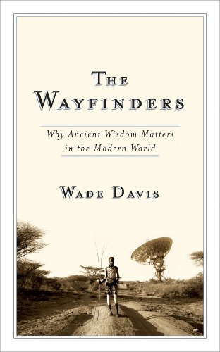
The debate could last all night: the Massey Lecture, better on the radio or in a book? I’ve taken Margaret Atwood, Thomas King and Ronald Wright in book form; Neil Turok, Adam Gopnik and Lawrence Hill via the ear bud. But there’s really no wrong answer.

Wade Davis’s Massey entrée—a five-part meditation on what, collectively, indigenous culture and learning can teach the Western tradition about its own unwittingly single-minded pursuit of progress (a narrow assumption, but let’s leave that)—is worth the read, even if it is, admittedly, 30% (or so) re-purposed content from The Serpent and the Rainbow, Light at the Edge of the World, and other Davis gems. Also a WOTS purchase.

What this book says about 2014 me: That I will read anything by celebrity anthropologists whose job title includes “explorer in residence” and whose writing abets subconscious feelings of discomfort in my own skin, in this case as a white, middle-class man self-doubtingly of no particular worthwhile culture. Also, this is what Wade Davis’s writing studio looks like; the revelation of which has positively altered the scale and frequency of my daydreams about my ideally architected writing cave.


4. Emma Goldman, by Vivian Gormick

It might not take five fingers to count the number of non-work or –school-related biographies I’ve read, but this two-dollar purchase at Word on the Street made a compelling case for the shortlist: effortlessly smooth prose; under 150 pages; and starring one of history’s most underrated political superstars.

What this book says about 2014 me: That a year after arguably the world’s most influential contemporary intellectual-activist (and avowed anarchist) Noam Chomsky received some belated justice in the form of the CIA admitting it had illegally spied on him during the 1970s, when we are experiencing a political society in which democratic governments censor science, spy on citizens, militarize their police forces, suppress labour rights, etc, etc; the life, times and irrepressible passions of America’s greatest anarchist—Emma Goldman—are as stirring a story as ever. And we all need to be stirred.


5. Chasing Venus: The Race to Measure the Heavens, by Andrea Wulf

A collaboration between history and science in the adventurous story of a global, eighteenth-century competition to map the dimensions of the solar system by triangulating the transit of Venus across the sun, a theory proposed by Edmund “The Comet” Halley. Okay, it is almost as dry as it sounds, but IFL Science, right?!

Seriously, more than two hundred years before the births of Sergey Brin and Larry Page, a motley host of professional and hilariously rich and amateur scientists worked together to travel, often dangerously, to various points of the globe (taking months or years or decades of their lives) to observe a rare celestial phenomenon that might help give the world the gift of longitude and thus an accurate map of the planet, at last.

What this book says about 2014 me: That Simon Winchester fatigue has a cure in dry, fact-heavy scientific historical narrative that is still more entertaining than an introverted Friday night home alone with Wikipedia; that I vicariously live through any writer who spends the bulk of her time in archives “interviewing” dead people instead of talking to live ones.


6. To a Mountain in Tibet, by Colin Thubron

A shoe-in to make this list based solely on the fact that I bought it randomly from the travel book section of the legendary Powell’s Books in Portland. The story of a late-in-life successful English travel writer who undertakes a contemplative journey through Nepal and Tibet to Kailash, the holy mountain of Buddhist and Hindu tradition, during which he extrapolates and shares a personal theory of spirituality from his encounters along the way.

What this book says about 2014 me: That scheduling books according to hypothetical travel plans—in this case buying the book in Portland one year; reading it while walking in the Himalaya foothills of India the next—is rewarding both as a reader and as a compulsive scheduler. (Cf. David Macfarlane’s The Danger Tree patiently waiting for my TBD trip to Newfoundland. Waiting is tough; obviously I couldn’t hold Geography of Blood until I visited Saskatchewan.)

Also, put “walking in foothills”—any foothills will likely do, so long as they’re contemplative—on your 2015 to-do list.


7. Our Ice is Vanishing, Sikuvut Nunguliqtuq, by Shelley Wright

My wife brought home an advance copy of this book of Arctic history, politics and science from her work and I decided to read it during an August heat wave and pitch its review to a magazine. To find out why you should read this book, pick up the November-December issue of This Magazine. (Or subscribe: it’s a great magazine!)

What this book says about 2014 me: That sometimes the perfect book comes along just as I’m feeling frustrated at my prime minister’s dramatizing of a mildly interesting but narrowly significant event (in a region, the Arctic, that needs more significant media coverage), and then the editor of my favourite little magazine says she’s short one book review for the next issue and she’ll take one; that this entire minor episode encapsulates why I feel so needy with non-fiction literature and love to read, write and read. There are so many more books I want to tell you about, but I’ll have to stop here.

Happy new year, and happy reading in 2015! 

Paddling the Mattagami and Moose Rivers north to Moosonee

On a mucky gravel bar downriver from a towering hydro dam we took to the water like creaky old boy scouts, haphazardly greased in bug juice and squinting through the drizzle.

All around us the boreal forest went by as unmetered verse:

Spruce, spruce, birch, spruce,
Birch, spruce, spruce, spruce, birch,
Spruce, birch, spruce,
Spruce, spruce, birch, birch…

The water curdled to life as rapids and goose tails and the breaching of trout, while on either bank the dark, empty woods remained disarmingly silent.

The Mattagami River at sunset from Sandbar Island


This is a summary account of an expedition of the lower Mattagami and Moose Rivers from July 29 to August 6, 2014. Three men, two boats (one a 17-foot Nova Craft Prospector canoe; the other a 13.5-foot open-water kayak) and about two hundred and fifty pounds of outfit.

Part I: 86km on the Mattagami River from Kipling OPG Hydro Station to the junction with the Missinaibi River and the start of the Moose River.

Part II: 94km on the Moose River from the Missinaibi junction to the (former) Tidewater Provincial Park.

Part III: Moose Factory, Moosonee, and the Polar Bear Express.

Part IV: Tips for interested trippers

Continue reading “Paddling the Mattagami and Moose Rivers north to Moosonee”

End of E6 in Toronto?

On a recent canoe trip down the Mattagami River, tucked into my drybags amongst the fleece and flannel were seven rolls of Fuji Velvia 100, one of the most brilliant 35mm films ever made. Velvia is transparency (or “slide”) film and requires a unique chromogenic process known as E6 to develop the images exposed.

[This post has been updated on Sept 9, 2014. See below.]

E6 processing involves up to six chemical baths for development, several of which are unique to slide film (as opposed to negative film that nowadays is mostly C41 processed). As a hobbyist I’ve never ventured into E6 and have always taken my slide film to a lab.

As of this summer, I’m told, the company that supplied Toronto’s photography labs with those chemicals has ceased importing them from Japan. (I also learned from one lab that one of the parts used in the process, made by a German company, is also out of distribution.)

Thus, Toronto’s major labs — including Toronto Image Works, Northern Artists, and Downtown Camera — have ceased to offer E6 processing.

But there is still hope, for now. An enthusiastic Toronto photographer named David Nardi is offering E6 processing service by mail order. Check out his website e6it.ca for details.

Earlier this month I met him in the lobby of his High Park condo amid nearly a dozen others dropping off orders of either 35mm slide film or 120 negative film, which he also develops. I’m still waiting for the results — his lab is out in the country and he is just one person, after all — but I’m as curious about his developments as I am contemplative of the end of an era.

Results to be posted soon. In addition to David Nardi, the labs also recommended Borealis Lab in Montreal, which accepts E6 orders by mail for processing.

Meanwhile, if any readers have any news or further details about E6 in Toronto, please comment or contact me.

Update September 9, 2014: David Nardi at e6it.ca has announced on his website that he is suspending services due to demand. The site also points users to labs that, for the time being, are still offering E6 processing: VCG Creative Imaging in Toronto and Borealis in Montreal.

This has always been a one-man, part-time, low-volume, batch processing operation. My machine is wonderfully versatile, however it cannot support the large quantities of film that I’ve been receiving. My throughput is quite low and my last run has taken a week to complete: this, combined with a relentless full-time work schedule has hampered my ability to offer reasonable and timely runs in the future.

Viva Velvia.

Photos by Richard A. Johnson