
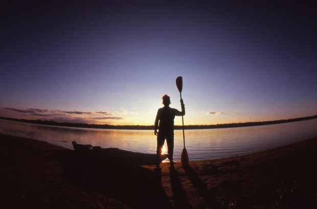
On a mucky gravel bar downriver from a towering hydro dam we took to the water like creaky old boy scouts, haphazardly greased in bug juice and squinting through the drizzle.
All around us the boreal forest went by as unmetered verse:
Spruce, spruce, birch, spruce,
Birch, spruce, spruce, spruce, birch,
Spruce, birch, spruce,
Spruce, spruce, birch, birch…
The water curdled to life as rapids and goose tails and the breaching of trout, while on either bank the dark, empty woods remained disarmingly silent.

This is a summary account of an expedition of the lower Mattagami and Moose Rivers from July 29 to August 6, 2014. Three men, two boats (one a 17-foot Nova Craft Prospector canoe; the other a 13.5-foot open-water kayak) and about two hundred and fifty pounds of outfit.
Part I: 86km on the Mattagami River from Kipling OPG Hydro Station to the junction with the Missinaibi River and the start of the Moose River.
Part II: 94km on the Moose River from the Missinaibi junction to the (former) Tidewater Provincial Park.
Part III: Moose Factory, Moosonee, and the Polar Bear Express.
Part IV: Tips for interested trippers
Part I: 86km on the Mattagami River from Kipling OPG Hydro Station to the junction of the Missinaibi River and the start of the Moose River
On our first afternoon following the three-hour drive north along Fraserdale Road from Cochrane, we paddled 16km to Adam Creek Provincial Reserve, where a series of elevated gravel bars on either side offers a few good options for tenting. The next day we took it easy, too; just 24 swift-current kilometres to the Pike River inlet just short of the Grand Rapids, which we wanted to tackle in the morning. We camped on the narrow shore of the left bank, as the right was noticeably steeper and buggier.
On each of our first two mornings, a black bear wandered close as we ate breakfast, and sloughed away just as lazily after some astute anti-bear action.
On Day 3, we shot the Grand Rapids (listed as Class II/III; closer to Class II in the mid-summer lower water) and the subsequent Long Rapids (Class I and a half, let’s say), then followed that up by huffing it 40km down the winding, high-banked river, sighting plenty of geese, until we reached Sandbar Island, possibly so named because that’s where your jaw drops when you reach it.
On the morning of Day 4, we paddled the final 6km of the Mattagami to its confluence with the Missinaibi. In Ojibway, mattagami means “meeting of the waters.” (Another translation calls it “turbulent waters.”) From its source north of Sudbury–across the Arctic watershed from headwaters of the south-flowing Spanish River–the river travels 443km to reach this point, draining a basin of nearly 10 million acres. Standing in a foot-deep, grey-brown current, we contemplated this over fistfuls of peanut M&Ms.


Part II: 94km on the Moose River from the Missinaibi junction to the (former) Tidewater Provincial Park
“There are two types of people in the world: those who can get comfortable in a canoe, and those who can’t.”
— George Simpson, 19th-century Hudson’s Bay Company explorer
Where the two rivers come together to form the Moose you are inside Missinaibi Provincial Park for the next 17km. For the fourth night we camped on the mosquito-infested northern tip of Mike Island overlooking the Moose River Bridge, where the fishing is so superb that twice we snapped a line reeling in big ones.
Days 5 and 6 were each about 27km, and the water here is slower, glassier, but still presents the occasional set of white-tipped waves.
Just before arriving at the Kwetabohigan Rapids, where the Moose really starts to widen, we began to experience a subtle shift in our environment: the smell of the sea on the headwind; the cropping of trees on the islands; the thinning of the forest along the shores; the peculiar sight of a seagull. We pulled over to photograph the shell of a wigwam before gleefully shooting the rapids (Class I/II) and tenting on the eponymous island, where through the evening’s foggy rain it looked as though we’d reached the end of the earth.


Day 7, at last, was hot and sunny, and after a short 15km paddle we set up our final campsite on Bushy Island, where the long afternoon sunshine dried out our clothes and gear, and the low-grade river bottom warmed the waters just enough for a brief swim.
Enjoying a cigar and the last of our single malt during the elongated magic hour, we watched the tidewater rise over our private beach, up to our kitchen and just to the edge of our tents; by morning, the beach had returned.
Part III: Moose Factory, Moosonee, and the Polar Bear Express
A strong headwind added a small degree of challenge to an otherwise straightforward 6km paddle to Moose Factory Island, where we tied up and dove into the showers at the Cree Village Eco Lodge. Strolling about the hamlet in between two large lodge meals we hazily took in the historical buildings of the HBC and the local Cree Cultural Interpretive Centre, where $10 gets you a private guided tour, or $10 gets you a private unguided tour (I recommend the former).
We opted for an early evening in the comfort of the lodge, but if you’re looking for local fun in Moose Factory, head down (smartly, in a car and/or with locals) at sunset to the dump for the bear show.
The next morning, we paddled across the expanse of the river to Moosonee, with a final slog up a creek to a bridge just a block from the railway station. (The other option is to dock with the water taxis and portage seven blocks through town.)
After postcards and a KFC/Pizza Hut picnic courtesy of the Northern Store, we boarded the outbound Polar Bear Express at 5pm for the 5-hour sunset journey to Cochrane. Plunging on steel rails through the same forests that had seemed so forbidding from the boats, we felt a little bit like heroes, a little bit like aliens.
Night fell and we groped around the bottom of our dry bags for our smart phones, and looked longingly for a signal as the train whistled into town.


Part IV: A few notes for interested trippers
Technically, this is not an advanced route, but its remoteness requires that you know left from right in the bush: topographic maps, compass, wilderness first aid, bear safety, etc; all backed by meticulous planning.
If you’re not comfortable with a self-guided trip, the team at Howling Wolf Expeditions will lead you and feed you. We hired them to shuttle us and our boats from Cochrane 190km to Kipling, then took off on our own.
For information on water levels and access through the security zones of the Lower Mattagami River Project, contact the OPG Public Affairs office. As of 2014, the refurbishing of the four hydro stations is still in effect. Best not to head up the lonely Fraserdale Road without warning them that you’re coming; we required a security escort from Little Long reservoir all the way (21km) to Kipling.
We did not take a sat-phone, but it is well-advised to do so.
For the part of the journey that passes through Missinaibi Provincial Park, get your permits ahead of time from Ontario Parks if you plan to camp on park territory. Will there be anyone out there to check? No, but do the right thing anyway. In 2012, Ontario Parks shut down Tidewater Provincial Park and handed it over to the town of Moosonee. Officially, it is now a day-use only park.
The Ontario MNR Make-Your-Own-Topographic-Map tool is indispensable for planning.
Study the route and schedule of the Polar Bear Express and the freight trains. If you get into serious trouble, you might have the option to hack into the bush and flag town a train.
Don’t expect to see man-made signs marking campsites, and try not to make your own.
Our pace on the water was about 7.5km per hour, excluding breaks, or 5km per hour with breaks. Sprinters could do this stretch of river in 5 days; we chose 7+ for comfort.
Be aware that, on the lower Mattagami, the river may rise or fall by a couple of feet per day depending on flow through the dams. In the tidal estuary of James Bay, which reaches 25km up river from the coast, the Moose River will similarly rise and fall according to the moon’s gravitational reach. Think about that before you step on those tent pegs.
Remember your Monkey’s Fist.
Learn a few words and phrases in Cree. The territory you’re paddling through is the homeland of various Cree bands, and on the Moose you’ll likely see a few cabins and outboard canoes with fishermen and women. English works just fine, français ça et là, but why not be that awkward, endearing human who attempts the local tongue.


All photographs copyright 2014 Richard A. Johnson. Photos via Canon 15mm “fisheye” lens, Fuji Velvia.
